Patterson Brook Forest
Hults Road : Worcester, VT 05682
Washington County, Vermont
Farm Description
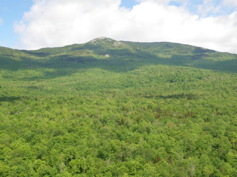
The 1,003-acre Patterson Brook Forest represents one of the largest private ownerships within the Montpelier region of central Vermont. With nearly two miles of high elevation terrain in common with Vermont’s Putnam State Forest, this forestland offers unparalleled access to and views of Mount Hunger, one of the region’s scenic landmarks. The property lies on the eastern flanks of the Worcester Range in Worcester, Vermont, in the north-central part of the state. The Worcester Range runs north-south just east of and parallel to the Green Mountain Range. Worcester is primarily a bedroom community for Montpelier, Barre, Waterbury and larger employers in the Burlington region. Downtown Montpelier, located 10 miles to the south, is the hub of the region and offers numerous shops and restaurants, a lively cultural scene, several colleges, state government and an array of employers.
The forest’s stunning view shed, developed internal access to high upland sites and end-of-road privacy combine to offer a significant kingdom lot opportunity close to the Montpelier region. Multiple homesite options are available off the internal access road, each ideally suited for a weekend retreat, retirement home or a large, working homestead. Much of the terrain is well-drained and gently-to-moderately sloped, and the land’s high elevation gives rise to the unique views to the south towards the Winooski River Valley and those to the west of the Worcester Range and the Putnam State Forest. The northern section of the property, adjacent to the Putnam State Forest, includes Mount Hunger’s eastern ridge, a coveted location, and a private route to one of Vermont’s most hiked peaks. While somewhat remote, the land’s most intriguing site sits at the end of the western trail where level terrain unfolds less than a mile from Hunger, White Rock and Burnt Mountains.
The forest has benefited from a long tenure of professional stewardship. The current Capital Timber Value (CTV) accounts for half of the purchase price, with the balance realistically covering the bare land value held by the property’s multiple-use opportunities.The forest’s upland terrain has resulted in a timber resource dominated by northern hardwoods. The maples are the major species, followed by yellow birch and spruce/fir. The lower, eastern extreme of the land host several small pine plantations, convenient and aesthetically attractive sites for home development while the northernmost area situated along Mount Hunger’s eastern holds some of the property’s oldest trees with spruce and yellow birch well in excess of 125 years.


